We are pleased to announce an exciting new alliance between Active Living Research and GP RED to co-host and coordinate...
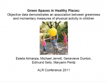
Green Spaces in Healthy Places: Objective Data Demonstrates an Association between Greenness and Momentary Measures of Physical Activity in Children

Presentation at the 2011 Active Living Research Annual Conference
A Study of Community Design, Greenness, and Physical Activity in Children using Satellite, GPS and Accelerometer Data
E Almanza, M Jerrett, GF Dunton, E Seto, & MA Pentz
DOWNLOAD: Full article
Background:
In part, the U.S. obesity epidemic is linked to community designs that do not promote active living. A smart growth community, however, contains features likely to promote active living (walkability, green space, mixed land use). Yet, the mechanisms by which community design leads to varied behavior are uncertain. Most studies to date have been cross sectional, drawing from self-report data, limiting inferences drawn about locations of activity. In contrast, the Healthy PLACES study near Chino, California, is collecting objective activity and mobility data with global positioning system (GPS) and accelerometer units for studying the connection between community design and physical activity. Simultaneous monitoring takes place in a free-living setting for participants living in either a smart growth or conventionally designed community.
The logging of continuous measures of location and speed by GPS devices, and physical activity by accelerometers, provides an opportunity to objectively measure behavior within environmental contexts. However, this approach presents new challenges on how to manage data cleaning and merging. We review some of the most recent approaches to these challenges. We also detail how we addressed data merging and manipulation, and report our preliminary findings here with respect to the greater association of green areas, such as parks, with higher physical activity levels.
Objectives:
The first objective of this presentation will be to summarize some of the key methods used for the merging of GPS data with other measures in environmental health and related fields. Additionally, the authors will detail their approach to data merging and manipulation. The benefits and limitations to alternative approaches will be discussed.
The second objective will be to present results from analysis conducted on the association of remotely sensed Normalized Difference Vegetation Index (NDVI), an indicator for green space, with physical activity level. Results from currently ongoing analyses will also be presented, including stratified analyses by demographics and community design group.
Methods:
The Healthy PLACES study consists of a matched case-control and randomized trial design and will examine cross-sectional and longitudinal effects of residing in a smart growth community. Due to the desire of many to live in a newly developed smart growth community a lottery was held to select new residents, thus enabling a natural experiment for this study. Survey, environmental, anthropomorphic, GPS, and accelerometer data are collected annually from 1 parent and 1 child of participant families for 4 years. Date and time stamped location, speed and activity measures are taken every 30 seconds for 7 days, except when sleeping or bathing. Currently we have data from approximately 800 participants.
GPS and accelerometer data were merged, cleaned and manipulated in the R programming language. Algorithms were written to match records by date and time stamps and to identify non-wear time and outliers. Sensitivity analyses are currently being conducted on methods for identification and imputation of outlier data points.
A 3-D geovisualization and Kernel density surface on a subset of data were generated in a geographic information system (GIS) to detect spatial patterns within the data. Specifically, space-time-activity paths were created and overlaid on digital landscape imagery, and a density surface of moderate and vigorous physical activity levels was constructed to reveal potential hotspots of high levels of activity. Additionally, an analysis was conducted to examine the association between level of physical activity and green space. Remotely sensed NDVI, an indicator for vegetation, was used as a proxy for green space.
Results:
Results from the Kernel density on a subset of data suggest green space nested within neighborhoods may be associated with higher physical activity levels. A follow-up analysis found a statistically significant positive association between mean NDVI, the proxy for green space, and level of physical activity.
We are currently carrying out analyses on the full dataset which further explore how the relationship between NDVI and physical activity behaves upon stratification by various demographics and community design group.
Conclusions:
The Healthy PLACES study provides a rich and diverse dataset for objectively assessing physical activity behavior. One challenge will be to standardize methods for managing large streams of personal monitoring data. That said, our preliminary results suggest that green spaces nested within neighborhoods are associated with higher physical activity levels.
Support:
Funding for this project was provided by the National Cancer Institute, Active Living Research, the ASPH-CDC Environmental Health Scholarship, and the UC Berkeley Chancellor’s Fellowship.
- DOWNLOAD "2011_GPS_Almanza_0.pdf" PDF (2.65 MB) Presentations
Related Tools & Resources
STAY UP TO DATE
RECENTLY ADDED TOOLS & RESOURCES
MOVE! A BLOG ABOUT ACTIVE LIVING
The "Active Living Conference" aims to break down research and practice silos and...


